Property Record
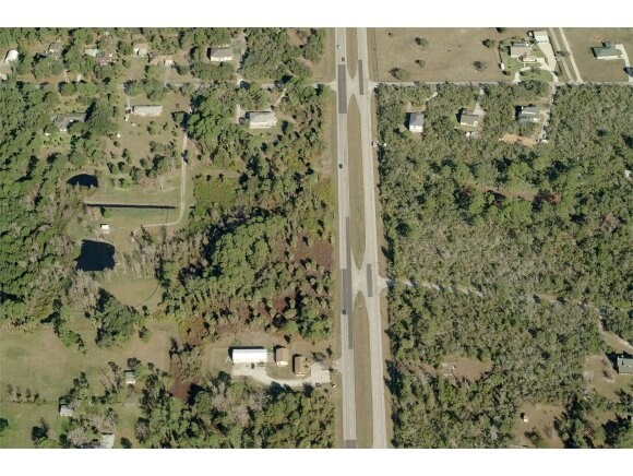
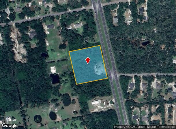
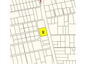
4150 Us Highway 1, Mims, FL 32754
NEARBY LISTINGS FOR SALE OR LEASE
Property Detail
4150 Us Highway 1
Palm Bay-Melbourne-Titusville, FL
Acreage
20-35-31-00-00254.0-0000.00
PART OF GOVT LOT 3 & W 1/2 OF SW 1/4 W OF US 1 AS DESC IN ORB 465 PG 614 & VACATED HARDEE DR ON EAST
Recreationalacreage
Brevard
A
Florida
12009C0105H
3
2024
3.49 AC
2025
Brevard County
060103
Orlando
DEMOGRAPHICS near 4150 Us Highway 1
1 Mile
3 Mile
5 Mile
2024 Total Population
1,224
7,240
12,893
2029 Population
1,346
8,012
14,255
Pop Growth 2024-2029
+ 9.97%
+ 10.66%
+ 10.56%
Average Age
46
46
46
2024 Total Households
512
3,036
5,342
HH Growth 2024-2029
+ 9.77%
+ 10.51%
+ 10.48%
Median Household Inc
$58,147
$63,321
$62,434
Avg Household Size
2.40
2.30
2.30
2024 Avg HH Vehicles
2.00
2.00
2.00
Median Home Value
$285,092
$271,104
$260,641
Median Year Built
1986
1987
1987
Nearby Places
Map Layers
Map Styles
 Street
 Aerial
- Restaurants
- Banks
- Shops
- Fitness
- Groceries
Nearby Properties
Address
Land Use
TOTAL SIZE
Lot Size
Zoning
Address
Land Use
TOTAL SIZE
Lot Size
Zoning
70,928 SF
15 AC
RU-1-9
Address
Land Use
TOTAL SIZE
Lot Size
Zoning
114.31 AC
GU
Address
Land Use
TOTAL SIZE
Lot Size
Zoning
87.58 AC
GML
Address
Land Use
TOTAL SIZE
Lot Size
Zoning
36,557 SF
5.62 AC
IN(L)
Address
Land Use
TOTAL SIZE
Lot Size
Zoning
19,137 SF
5.91 AC
BU-1
Address
Land Use
TOTAL SIZE
Lot Size
Zoning
17,042 SF
2.75 AC
BU2
Address
Land Use
TOTAL SIZE
Lot Size
Zoning
4,860 SF
10.38 AC
RVP
Address
Land Use
TOTAL SIZE
Lot Size
Zoning
4,164 SF
8.98 AC
RVP
Address
Land Use
TOTAL SIZE
Lot Size
Zoning
22,879 SF
6.48 AC
PUD
Address
Land Use
TOTAL SIZE
Lot Size
Zoning
10,291 SF
10.45 AC
BU-2
Address
Land Use
TOTAL SIZE
Lot Size
Zoning
24,656 SF
6.69 AC
BU1BU2
Address
Land Use
TOTAL SIZE
Lot Size
Zoning
9,100 SF
1.48 AC
BU-1
Address
Land Use
TOTAL SIZE
Lot Size
Zoning
22,155 SF
2.18 AC
BU2
Address
Land Use
TOTAL SIZE
Lot Size
Zoning
7,598 SF
3.02 AC
GML
Address
Land Use
TOTAL SIZE
Lot Size
Zoning
133.98 AC
PUD
Address
Land Use
TOTAL SIZE
Lot Size
Zoning
9,250 SF
28.63 AC
INL
Address
Land Use
TOTAL SIZE
Lot Size
Zoning
59.45 AC
RU-1-11
Address
Land Use
TOTAL SIZE
Lot Size
Zoning
9,600 SF
6.56 AC
BU-1
Address
Land Use
TOTAL SIZE
Lot Size
Zoning
163.33 AC
PUD
Address
Land Use
TOTAL SIZE
Lot Size
Zoning
14,282 SF
1.65 AC
BU-2
Address
Land Use
TOTAL SIZE
Lot Size
Zoning
5,311 SF
7.24 AC
AU
Address
Land Use
TOTAL SIZE
Lot Size
Zoning
8,016 SF
5 AC
AU
Address
Land Use
TOTAL SIZE
Lot Size
Zoning
4,209 SF
39.08 AC
AU
Address
Land Use
TOTAL SIZE
Lot Size
Zoning
9,500 SF
5 AC
AU
Address
Land Use
TOTAL SIZE
Lot Size
Zoning
70.31 AC
PUD
Address
Land Use
TOTAL SIZE
Lot Size
Zoning
205.20 AC
GML(H)
Address
Land Use
TOTAL SIZE
Lot Size
Zoning
639 AC
GU
Address
Land Use
TOTAL SIZE
Lot Size
Zoning
9,624 SF
5.13 AC
BU1
Address
Land Use
TOTAL SIZE
Lot Size
Zoning
8,187 SF
1.82 AC
BU-2
Address
Land Use
TOTAL SIZE
Lot Size
Zoning
8,534 SF
19.47 AC
AU
The World's #1 Commercial Real Estate Marketplace
Connect with us
© 2025 CoStar Group
The information above has been obtained from sources believed reliable. While we do not doubt its accuracy we have not verified it and make no guarantee, warranty or representation about it. It is your responsibility to independently confirm its accuracy and completeness. Any projections, opinions, assumptions, or estimates used are for example only and do not represent the current or future performance of the property. The value of this transaction to you depends on tax and other factors which should be evaluated by your tax, financial, and legal advisors. You and your advisors should conduct a careful, independent investigation of the property to determine to your satisfaction the suitability of the property for your needs.